react-google-map 

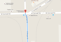
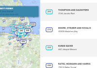
React component to render a Google Map with markers. You can use all official Google Maps API features.
https://developers.google.com/maps/documentation/javascript/reference
Install
npm install --save react-google-mapIf you don't have a solution to load googleMaps, you could use this package:
npm install --save react-google-maps-loaderChangelog
See changelog
Demo
http://xuopled.github.io/react-google-map/
Usage
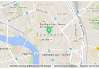
.map { height: 300px; } @media screen and (min-width: 1024px){ .map { height: 500px; } }import React, {PropTypes} from "react" import GoogleMap from "react-google-map" import GoogleMapLoader from "react-google-maps-loader" import iconMarker from "./assets/iconMarker.svg" import iconMarkerHover from "./assets/iconMarkerHover.svg" import styles from "./index.css" const MY_API_KEY = "AIzaSyDwsdjfskhdbfjsdjbfksiTgnoriOAoUOgsUqOs10J0" // fake const Map = ({googleMaps}) => ( // GoogleMap component has a 100% height style. // You have to set the DOM parent height. // So you can perfectly handle responsive with differents heights. <div className={styles.map}> <GoogleMap googleMaps={googleMaps} // You can add and remove coordinates on the fly. // The map will rerender new markers and remove the old ones. coordinates={[ { title: "Toulouse", position: { lat: 43.604363, lng: 1.443363, }, onLoaded: (googleMaps, map, marker) => { // Set Marker animation marker.setAnimation(googleMaps.Animation.BOUNCE) // Define Marker InfoWindow const infoWindow = new googleMaps.InfoWindow({ content: ` <div> <h3>Toulouse<h3> <div> Toulouse is the capital city of the southwestern French department of Haute-Garonne, as well as of the Occitanie region. </div> </div> `, }) // Open InfoWindow when Marker will be clicked googleMaps.event.addListener(marker, "click", () => { infoWindow.open(map, marker) }) // Change icon when Marker will be hovered googleMaps.event.addListener(marker, "mouseover", () => { marker.setIcon(iconMarkerHover) }) googleMaps.event.addListener(marker, "mouseout", () => { marker.setIcon(iconMarker) }) // Open InfoWindow directly infoWindow.open(map, marker) }, } ]} center={{lat: 43.604363, lng: 1.443363}} zoom={8} onLoaded={(googleMaps, map) => { map.setMapTypeId(googleMaps.MapTypeId.SATELLITE) }} /> </div> ) Map.propTypes = { googleMaps: PropTypes.object.isRequired, } export default GoogleMapLoader(Map, { libraries: ["places"], key: MY_API_KEY, }) Props
autoFitBounds: Boolean - Enable it if you will add and remove markers on the fly. Bounds will fit automaticallyboundsOffset: Number - IfautoFitBoundsenabled you want custom bounds, - by default is 0.002coordinates: Array of Marker props. You can use all props defined ingoogle.maps.MarkerOptionsobject specification (https://developers.google.com/maps/documentation/javascript/reference#MarkerOptions). If you need somegoogle.mapsconstants, use theonLoadedprop (onLoaded: (googleMaps, map, marker) => {}) to update your map and markers - by default is []googleMaps: Object - injected by placesLoader,onLoaded: Function with two parameters (onLoaded: (googleMaps, map) => {}),
You can use all props defined in google.maps.MapOptions object specification: https://developers.google.com/maps/documentation/javascript/reference#MapOptions
If you need some google.maps constants, use the onLoaded prop
Development
Clean lib folder
npm run cleanBuild lib folder
npm run buildWatch src folder
npm run watchLint src folder
npm run lintLicense
See MIT
